> ## Documentation Index
> Fetch the complete documentation index at: https://docs.jitra.app/llms.txt
> Use this file to discover all available pages before exploring further.
# Showing Traffic on the Map
> Learn how to switch to Google Maps and display available traffic conditions on the Jitra Tracking map.
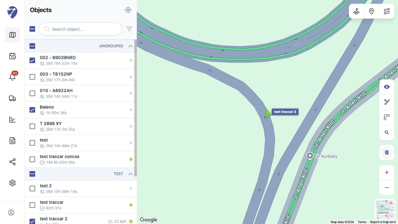
The Traffic layer adds available road congestion information to the Tracking map. This control is available when Google Maps is selected.
## Switching to Google Maps
Click Maps in the lower-right corner, then select Google. The Traffic button appears with the other controls on the right side of the map.
## Showing Traffic
1. Click Traffic on the right side of the map.
2. Wait for the road condition overlay to load.
3. Continue monitoring Object markers above the traffic layer.
 ## Understanding Traffic Colors
Traffic colors indicate the relative flow reported for a road. Green generally represents smoother traffic, while orange and red indicate increasing congestion. Coverage and freshness depend on the map provider.
## Hiding Traffic
Click Traffic again to remove the overlay. Switching to OpenStreetMap also removes the Google traffic control.
## Understanding Traffic Colors
Traffic colors indicate the relative flow reported for a road. Green generally represents smoother traffic, while orange and red indicate increasing congestion. Coverage and freshness depend on the map provider.
## Hiding Traffic
Click Traffic again to remove the overlay. Switching to OpenStreetMap also removes the Google traffic control.