
Tracking supports several map views so you can choose the road detail or imagery that best suits the current task.

Opening the Maps Selector

Click the Maps thumbnail in the lower-right corner of the Tracking map.
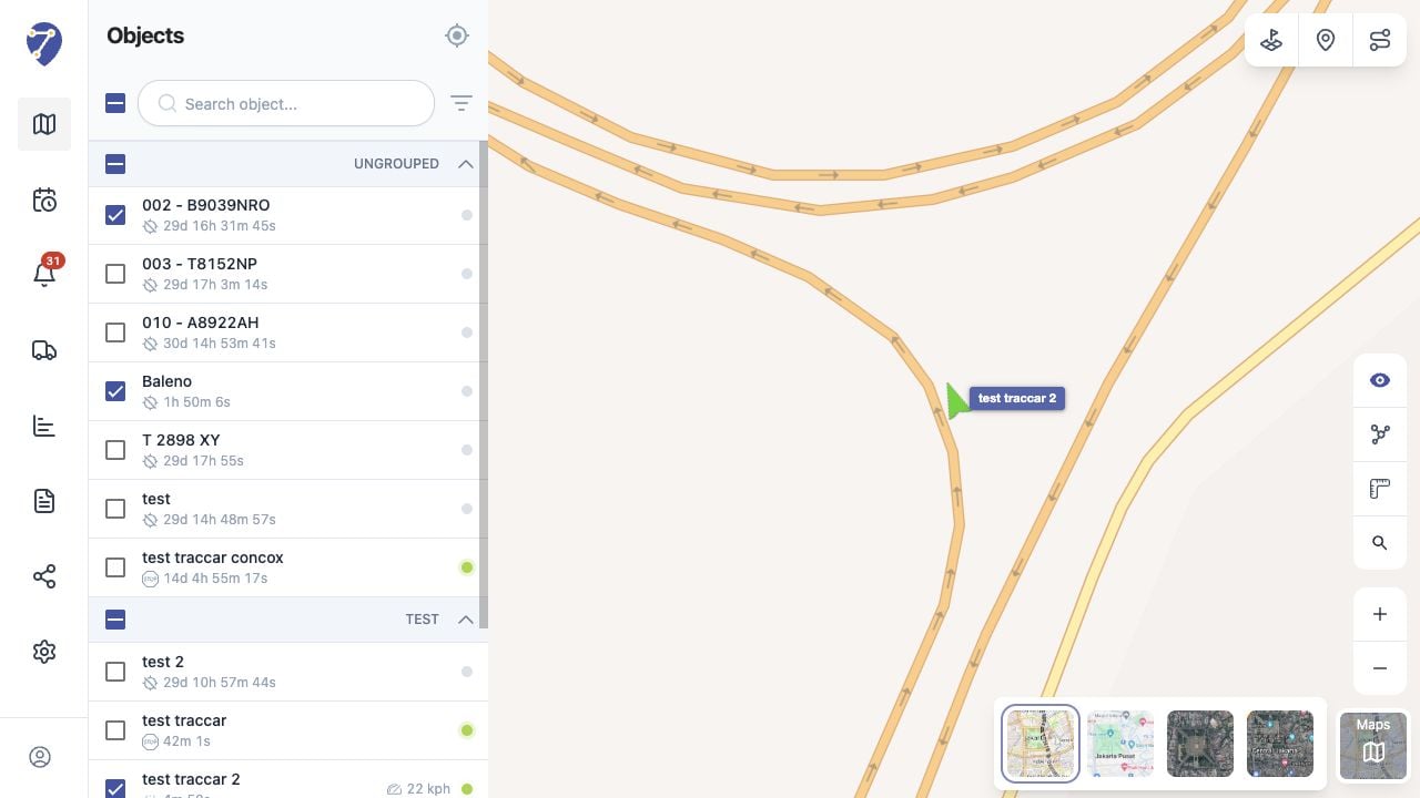
Switching Between Google Maps and OpenStreetMap in Jitra staging

Available Map Views

  • Open Street: OpenStreetMap road data
  • Google: standard Google road map
  • Google Satellite: satellite imagery
  • Google Hybrid: satellite imagery with road and place labels

Switching the Active Map

Select a thumbnail to apply that view. Object markers and open map resources remain available while the base map changes.

Features That Depend on the Map

Traffic is available when Google Maps is active and is not shown with OpenStreetMap. Map labels, imagery, address coverage, and update frequency can also differ between providers.