
A Geofence is a custom polygon boundary used to represent an operational area. It can be displayed on the map and used by Event rules such as Entrance Geofence and Exit Geofence.

Opening Geofences

Open Tracking and click Show Geofences. The panel lists saved Geofences and provides search, selection, creation, and action controls.
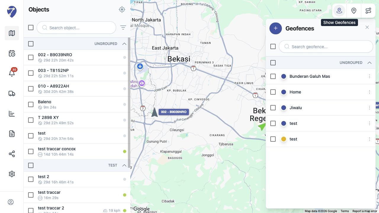
Understanding Geofences in Jitra staging

Geofence Information

  • Name: the label shown in the Geofences panel
  • Color: the polygon outline and fill color
  • Group: the optional Place Group
  • Description: additional information about the area
  • Boundary: the polygon drawn on the map

Using Place Groups

The Group field can organize related Geofences. The panel displays grouped and Ungrouped items under separate headings.

Using Geofences on the Map

Select the checkbox beside a Geofence to draw its colored boundary on the map. Selecting several Geofences displays them together.